The Geodetic Center of the United States
Osbourne Kansas
The Geodetic Center of the United States is marked by a roadside marker, determined by the Army Corps of Engineers. Not to be confused with the Geographic Center (Lebanon, Kansas), the Geodetic Center is the point at which all measurements for North America are taken- kinda’ like the Greenwich Mean Time for cartographers. While the plaque is in Osbourne, the official marker is on Meade’s Ranch, off the highway.
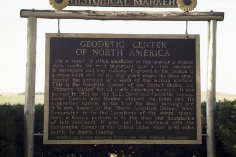
Geodetic Center of the United States Plaque - posted on an Historical Marker sign in Osbourne KS:
"On a ranch 6 miles southeast of this marker a bronze plate marks the most important spot on this continent to surveyors and map makers. Engraved in the bronze is a cross-mark and on the tiny point where the lines cross depend the surveys of a sixth of the worlds surface. This is the Geodetic Center of the United States. The "Primary Station" for all North American surveys. It was located in 1901 by the U.S. Coast and Geodetic Survey. Later Canada and Mexico adopted the point and its supporting system as the base for their surveys and it is now known as the "North American Datum." What Greenwich is to the Longitude of the world, there-fore, a Kansas pasture is to the lines and boundaries of this continent.It must not be confused with the Geographic Center of the United States, which is 42 miles north, in Smith County. "
- Erected by Kansas Histroical Society and State Highway Commission.
Geodetic Center of the United Stats Stats:
It's in the middle.
Smack Dab.
Tips? Photos? Please share:
World's Largest Things
PO Box 101
Lucas, KS 67648
info@WorldsLargestThings.com
| Home | | Store | | Become a Member | | What's Large Where | | What's New |
copyright and trademark ERNCO Value Added Products and World's Largest Things